The C.N.I.G.S. (national geospatial information centre) is an autonomous institution part of the Ministry of Planning and External Cooperation.
Its mission is to produce and spread the updated and reliable geographic information on the national territory through the use of appropriate modern technologies. The C.N.I.G.S. also needs to ensure the availability of methods, tools, products and training which must support the planning of sustainable development actions of the country.
The acquisition of an imajing equipment was made as part of the P.I.T.D.D. (territorial information program for the sustainable development), established by the C.N.I.G.S. and co-funded by the state of Haiti and the European Commission.
The C.N.I.G.S., together with the M.T.P.T.C. (department of public works, transport and communication) and the L.N.B.T.P. (national laboratory of building and public works), is liable to make visual surveys and to assess the condition of Haitian road network for the needs of construction, maintenance and planning.
A complete survey equipment is therefore required. A team of 8 technicians trained to use imajbox® and 10 technicians to use imajview, coming from the C.N.I.G.S., M.T.P.T.C. and from the L.N.B.T.P., was in charge of the execution of the project which has currently reached the closure phase.
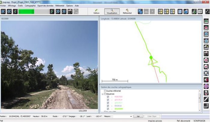
The team surveyed a total of 3 350 km thanks to the imajing solutions. They now have a complete images data base of the Haitian national road network.
According to Renaldo Sauveur, project manager at the C.N.I.G.S. The analysis of this data allowed the State of Haiti to improve its knowledge about the national road network, especially in terms of practicability, paving and conditions, for the purpose of work planning for constructions and road maintenance. » The imajing solutions have been demonstrating their adaptability in difficult survey conditions as Renaldo SAUVEUR testifies : « At first I was not sure about the solidity of imajbox nor about its stability, taking into account the difficult conditions of our roads, especially regarding the sharpness of the image, but it proved to be rock-solid while using it on the field. »