senseFly is a Swiss manufacturer of autonomous, ultra-light mapping drones (also called UAVs) and related software. Their network of approximately 40 value-added distributors serves 60 countries, including 3 companies that serve 21 African countries – plus they have a key accounts team and direct sales staff to serve customers in those markets where they don’t yet have distributors.
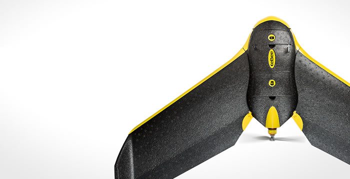
Their flagship product is the eBee, an easy-to-use and safe fixed-wing mapping drone. This solution is already employed by land surveyor professionals around the world, including many working in the fields of construction and mining.
The eBee is an advanced and fully automated geo-data collection tool. A user simply defines the area they want to map using the drone’s flight planning software and then they launch the drone by hand to automatically collect high-resolution aerial images of this area. They can then use their powerful post-flight software, powered by Pix4D, to ‘stitch’ these images together and create highly accurate 2D orthophotos and 3D elevation models. Or export these outputs into a wide range of third-party applications.
More recently senseFly also announced the eBee RTK, a survey-grade version of the eBee capable of producing orthomosaics and 3D models with absolute accuracy of down to 3 cm – without the need for Ground Control Points.
They supply their drones to numerous African countries via a mix of distributors and direct sales. Their two distribution partners for example supply senseFly technology into countries ranging from Angola and Congo to South Africa, Botswana and Mozambique.
Contacts;
senseFly Ltd