The Vanguard, is Airborne Drones most popular UAV, which is a long range surveillance drone with a configurable Data Link video Range and flight times. The Vanguard drone system is their solution to security and surveillance needs.
It is also ideal for inspection and detection where fine detail such as cracks and signs of wear are needed. The Vanguard has a dual camera configuration which gives you the ability to see what the Vanguard sees in real time and allows you to interchange between the two cameras while in flight. The Thermal camera allows you to detect objects, which you can then zoom in on when switching to the the 10x Optical Zoom camera. And with a first-of-its-kind dual antenna station, the Vanguard provides the clearest image even when it has been pushed to its limits!
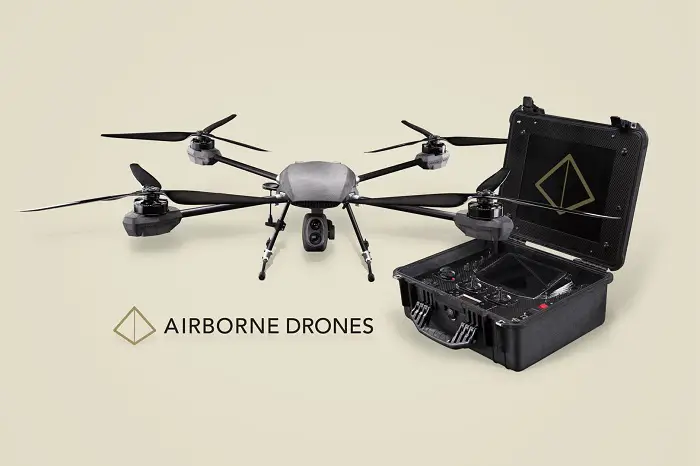
The Falcon
The Falcon’s new air frame and motor configuration is the new best in its class of light payloads with flight times of up to 50 minutes. This makes the Falcon ideal for small to medium farms that require the flight time of a fixed wing but the precision of a quad copter. The capture resolution of a quad copter allowing precision mapping of more complex areas such as construction sites and open mines.
With the Long Range FPV System and Directional Antenna System rated at 12km and flexible light payloads the FALCON is a real workhorse, with the range for all your needs and features unsurpassed in its class. It is ideal for Inspection and Mapping on a budget and designed to withstand the strongest winds. The Falcon’s open source design allows for low cost maintenance and the ability to repair the system easily by yourself in the field with generic tools and a set of optional spares.
Drone recommendation for surveying and mapping
Mapping
The definition of mapping is the graphical representation of information based on spatial relationships. Mapping is typically used to portray scaled geographical features forests, roads, and water. It is generally an ongoing process because regular changes in climate conditions and structural developments make it necessary to carry out regular mapping.
Originally, mapping involved just field measurements; however, the use of planes, and later helicopters, for aerial photography has significantly increased mapping possibilities. It is now possible, for example, to render multi spectral images which enable climatic measurements.
Performing aerial photography with helicopters and planes is expensive, requires trained personnel, and cannot be undertaken at certain times due to safety regulations. A mapping UAV provides the ideal alternative; they are cheaper to operate, can be instantly deployed, and can be programmed pre-flight to follow a route via way point grids. In addition to this, the data is stored as a hard copy which can be easily inputted in geo-mapping software, allowing the swift implementation of the data.
Ideal sensor: Fixed Sensor 24MP
Surveying
Surveying refers to the detailed inspection of an object or area in order to define its boundaries, establish its characteristics, and determine its potential. Surveying methods typically include observation, measurement, researching, and mapping. A survey is commonly performed in order to investigate an infrastructure, enable urban development, and assist in mining activities.
Surveyors use a number of different methods to gather information, including 3D measurement tools, sensing tools such as sniffer and infrared, and aerial photography. Each of these traditional surveying tools serves a specific purpose, and they must be used in conjunction with one another to build up the most accurate survey result, and this can be time consuming and costly.
Using a UAV for aerial mapping allows you to obtain detailed data quickly and easily. The drone enables you to bolt on whatever tools and accessories are required for each specific job, allowing you to customize the drone platform to achieve the best results. Aerial imagery and precise mapping serves as a replacement for traditional 3D measurement tools and sensing tools. A survey drone is therefore much more versatile and efficient that the traditional tools individually.
Ideal sensor: 10X Optical 24MP
A drone’s eye view
Gather High Definition (HD) video footage and photos, aerial shots of buildings and infrastructure for surveying and inspection purposes, all from a drone’s eye view.
Airborne Drones provides the surveyor or security monitor with a complete airborne UAV aerial mapping system.
Airborne UAV platforms
Airborne Drones recommends the AIRBORNE Solution with LiDAR and 4k optical zoom sensors for Surveying and Mapping Applications.
Airborne Drones focus on the design, manufacture, and marketing of long-range UAVs for mapping and surveying (10 and 20kms), able to carry payloads of up to 8kgs, for industrial strength commercial use. Long-range drone products have the potential for huge benefits for commerce and business. Solutions can be developed to meet specific client requirements. Our services can also include support and training during both pre and post implementation.
Airborne Drones services an international base of clients ranging from South Africa to the UAE. Clients include representatives from the following industries: Marketing, Real Estate, Security, Agriculture, Game Farms, Wildlife Management, Electrical Installations, Telecommunications, Travel and Tourism, Sheet Metal Manufacturing, Satellite Electronics, Wind Farms, Industrial Rope Access, Restaurant and Food, Environmental Affairs, Military Applications.
Airborne Drones has a strong team of engineers dedicated to their customers.
We recommend our systems for Mapping. All you will need is to purchase a license for PIX4D mapping software. Everything else already comes standard with your package to execute the most complex automated flights required.