The Availability of unlimited, accurate, data Drives Better Business Decisions. Rocketmine is changing the business intelligence game by reducing costs and increasing the speed of data collection, assisting companies to plan, execute and monitor more accurately.
Rocketmine is a one-stop, full service, Aerial Data Solutions provider.
- From Topographic surveys, volume calculations, stock pile and plant canopy measurement, to disaster management, site mapping, security applications and more – Rocketmine’s Aerial Data Solution is suited to any terrain or requirement, delivering accurate, affordable and reliable data. Professionally trained, delivering accurate data in the fastest time.
Solution Benefits
Rocketmine makes it easy to get up and flying within 24 hours. It Just Works. It is more cost effective, faster to deploy and less affected by weather, offering a higher safety value than traditional methodologies.
Rocketmine is your partner in delivering flexible, customizable, Aerial Data Solutions
- Collect high resolution imagery and critical data in a quick and cost-effective way
- Cover up to 1000ha per day with a single deployment of RocketMine’s UAV Solution
- Tick all the boxes in terms of Operations, Safety and Legal requirements
Rocketmine Delivers Accurate Data –
Faster than Traditional Methodologies.
Using our autonomous fixed-wing Unmanned Aerial System (UAS), you can generate high-resolution orthophotos/mosaics, NDVI maps, 3D-point-clouds and complete 3D-reconstructions.
A typical Rocketmine deployment would consist of:
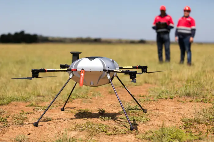
- An on-site pilot – professionally trained and licensed to operate different types of UAVs
- The latest in available UAV technology, customized to your requirement
- The latest in processing systems
- Comprehensive service contracts to ensure performance requirements are met
Our Pilots have over 1000 total flight hours and are Experienced in Operating Multiple Types of UAV.
Training and Certification in relevant Safety and Medical protocols is a must, as is expertise in avionics, geography and aerodynamics.
Before a UAV trainee becomes a Rocketmine Pilot, he/she has to:
- Have gained a minimum of 50 hours operating a UAV
- Pass regular Rocketmine Pilot Examinations and skills training
- Understand all Rules and Regulations set by governing bodies such as the CAA.
- Follow Rocketmine and Client (site-specific) Standard Operating Procedures
- Hold a current commercial or PPL license as per standards set by the International Civil Aviation Authority.
Delivering Accurate Data, Faster.
Operating a RPAS/UAV.
Flexible, Frequent and Fast.
Your data is produced to the highest quality, ensuring the sharpest resolution and accurate measurements – customised to your format requirements.
Rocketmine Delivers Accurate Data.
- Collect aerial photography of 1-10sqkm in a single flight down to 5cm precision.
- Shoot aerial imagery down to 3cm/pixel resolution
- Create maps and elevation models with a precision of 5cm.
- Gain Significantly more accurate data than LiDAR or Terrestrial Survey
- Choose fast data delivery, either on-site or via Rocketmine’s online delivery platform
Their Solutions includes:
Survey & Mapping
The low-cost survey solution that delivers data, faster and safer
Survey managers know that in order to meet tight project deadlines, you need a survey partner which is fast, accurate and cost effective.
Proven Accuracy and Results
Drone-based aerial photogrammetry has revolutionized how surveying teams operate.
Achieve a 95% confidence level of up to 30mm Root Mean Square, ensuring high resolution data, designed for accurate volumetric calculations and engineering plans.
Why Outsource your Survey operations?
As one of the first licensed commercial drone operators in South Africa, our experience allows us to provide the best fit-for-purpose solution which matches your business needs.
Save on technology costs, as well as administrative (and licensing) headaches – all you need is the data, delivered speedily and cost-effectively.
Security and Surveillance Solution
Solution includes sophisticated technology utilising incident data obtained from client to create a surveillance route for day and night time surveillance and for rapid response.
- Object tracking: sensor stays focussed on object while UAV flies. Car and people are tracked
- Thermal Mapping: up to 3km vision day and night
- Live data and video feed: allows for real-time signalling and faster security deployment
- Ground force integration: Know where the UAV is and where to deploy team to
- Minimal noise technology: Able to get closer to object for detailed facial recognition
- Extended flying time: When target is acquired, can stay on object until team is on site
- Ground station team: Consisting of licensed pilot and observer able to contact authorities at sign of any risk