
Project managers, job superintendents and on site engineers have more than their hands full overlooking the site operations and ensuring that everything is under control. Periodic inspections, asset management, risk assessment and maintaining worksite safety are all part and parcel of the job.
Add to that issues such as managing workplace productivity, resolving conflicts between workers and contractors etc. and you have quite the conundrum!
If only there was a way to inspect on site activities without having to leave the office! Well, technology makes that possible!
Commercial drones are a complete game changer for professionals in the AEC space and I’m happy how these little flying machines are gaining more popularity among construction agents and contractors.
Read on to know all about how laser scanning has changed in AEC industry spaces and why you should introduce drones for construction inspection
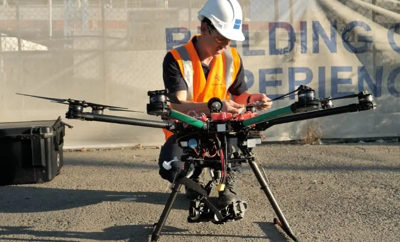
Construction surveys and drone tech
UAVs or unmanned aerial vehicles don’t need any human intervention. The UAVs come equipped with ground-based controllers and communication systems. This helps surveyors determine the exact location that needs to be captured.
Earlier, contractors used helicopters to take aerial footage of the site. This was an unnecessarily expensive and time consuming process where the surveyor had little to no control over the angles, flight altitudes etc.
With drones and laser scanners, this problem is effectively resolved.
Commercial drones can easily track and inspect a site faster, yielding more accurate results! It is surprising how reluctant construction companies are in adapting to drone technology and have only begun to explore the wonders of laser scanning in recent years.
Here are 5 ways drones improve your construction project
Conducting aerial surveys
With drones, contractors can conduct aerial site surveys without having to waste a lot of time. Manual inspections can take anywhere between a few days to a few weeks depending on the size of the project.
Drones, in comparison, can cover hundreds of acres within a few hours. Drones usually use GCPs or ground control points to set specific targets on the ground. These GCPs create a point of reference for surveyors that drones can follow while up in the air
Some UAVs also come with GPS integration which allows the drone pilot to maneuver the drone mid-flight depending on the land surveying needs.
Drone aerial surveys are mostly useful during the conceptual stage of the construction plan. This usually includes basic information such as land measurements, inspecting nearby roadway, powerlines, etc.
A small tip: always get your drones insured! This is a standard practice for drone pilots in Australia. Drone insurance covers both the damage done to the drone and the damages
done by the drone to third-party establishments in case of an accident.
HD images and drone footage
With 3D drone mapping, contractors can visualise how the building construction would look like in real life. Architects and engineers can then create a frame of reference for the design determining aspects such as the basic shape, structure and dimensions of the building
The point cloud images collected from the LiDAR drones are exported to a CAD or BIM model. The 3D replica model thus generated can be used for conceptual models, working prototypes or the final presentation model.
Drone footage collected from standard UAV drones are processed using a photogrammetry software. The drone footage can help architects detect errors in the design, rectify these errors and ensure that there is minimum wastage of resources.
Ensuring worksite safety
A construction site is a pretty dangerous place where a simple mistake can prove to be fatal. Worksite safety is the number one concern for an on site contractor or project manager. With drones you can ensure that the workforce is safe and out of harm’s way.
Drones can easily reach places that are inaccessible to humans. Earlier, workers had to risk their lives climbing rooftops or go down pipelines to check for leaks and damage. Today you can send in drones to do all the probing for you.
The data collected from drones is far more accurate as it is not prone to human errors. With the advent of drones, site surveyors can access data from their office.
Asset inspection and management
As project manager, your job also entails keeping an eye on the machinery, raw materials and other resources lying around the worksite.
And physically checking the construction materials and resources everyday is a cumbersome affair.
Drones make the job easier for you. With drones, you can get daily aerial footage of everything that happens on the worksite.
It also helps you keep tabs on the productivity of the workforce and deliver things well within the schedule.
Risk assessment
And last but not the least, drones help engineers and contractors detect damages, breakages, leaks faster. The faster you detect these damages, the faster you can repair them.
The 3D models are not only visually appealing but also easier to work with. You can easily change certain elements of the building design- both the exteriors and the interior decor.
And in some cases, engineers can also create 3D models of the entire neighbourhood. This provides a more holistic perspective as you can see the connecting roadways, nearest embankments, power lines etc that surround the construction site.
Drones therefore play a huge role in risk assessment and on site repairs.
Author Bio:
Chris Patchell is the General Manager & Director of Operations at Avian UAS. He is an avid drone enthusiast and loves drone racing. Chris is a go-getter, he has a very hands-on approach to things and right now his goal is to create awareness about drone tech in Australian AEC industries.
On off days, he is often bitten by the travel bug! On these days, you’ll probably find Chris travelling on his beloved bike, exploring new trails and routes.