
Oil pipelines are vast infrastructures often in difficult terrains such as marshlands, hot desserts or frozen areas, or even areas of conflict. The length of main pipelines in Russia exceeds 280 thousand kilometres while in America it exceeds 2,2million kilometres. And the world’s economies depend on these critical supplies of energy.
The extent of this infrastructure makes it hard to identify leaks in advance to avoid damages that can result.
Pipelines get monitored against various parameters, such as pipeline pressure and temperature, diameter of a pipeline rapture, layout of pipelines and type of transported fluid, etc.
While pipeline operators must carry out regular inspections of their equipment to ensure it is in safe working order, restrictions indetection of hidden leaks may result in liquid hydrocarbons getting into the ground up to the water bearing-layer.
Pipeline monitoring
Overview of Current Methods:
- Physical patrols
- Difficult to detect leaks visually, or by smell.
- Human inspections can only go so far as people are often limited when it comes to heights or confined spaces
- Inspection are constrained to pre-determined routes based on statistically sampling, leaving certain pipeline areas un-inspected.
- Pressure control method
- Difficult to detect small leaks
- Ultrasonic flowmeters
- Difficult to detect small leaks
- Expensive
- Conductive cables
- Difficult to detect small leaks
- Expensive
- Helicopter or plane
- Flies higher and quicker and has to carry heavy and expensive monitoring equipment
- It still provides comparatively low resolution images for the same money
- Cost of pilot
- Earth remote sensing data (via satellites)
- Low resolution images
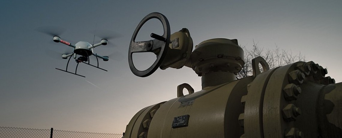
UAV-based sensor payloads used for pipeline monitoring
Different high quality sensors aboard the unmanned aerial vehicle (UAV), allow simultaneous inspecting of pipelines with respect to different criteria. UAV’s light weight provides for continuous scanning providing maximum safety at the same time.
UAVs ensure scanning of a pipeline at long distances and in hard-to-reach areas. UAVs can routinely fly closer to the ground at night, follow a very precise flight path, have lower operational costs and are more environmentally friendly.
Airborne Drones recommends that end users should identify the type of data that needs to be collected first, ie:
- High resolution color imagery to
identify
- Damage to pipeline
- Vegetation affecting pipeline
- Multispectral imagery to identify
- Monitoring pipeline right of way. Can be used in an agricultural space to detect plant health, but conversely it can be used to see the effect of pipe line on ecosystem and identify gas leaks.
- Occupying and damaging vegetation
- LiDAR to create 3D digital model
- Due to the high accuracy of Lidar models you can make 3D models (digital twins) of pipeline and its relation to the first digital model of when the pipeline was installed to work out where the pipeline has shifted to after time and predict possible damage and modify pipeline to pre-empt damage that can occur.
- Thermal identify possible defects
- Using general wave cameras using RGB imagery and thermal overlay you can predict weaknesses in pipes and possible leaks and send out inspection teams to measure if there is an actual leak or a bigger heat-shift reflecting structural failure.
In various combinations the above technologies can be used in the following methods:
- Digital photogrammetry.
- This allows identifying faults in earth morphology through the analysis of chromatic variation of relief changes using specialized tolls and software. The result of this method is the KMZ file or geo-information file intended to control map data when identifying the location of detected changes. This method can be applied to monitor hydrocarbon pipelines laid above and underground.
- Spectrometric method
- Two types of sensors are used todetect and identify hydrocarbon leaks in a liquid or gaseous state:multispectral and hyperspectral.
- Geothermal surveying method
- Thermal imaging cameras make it possible to analyze tendencies ofremote IR spectrum. It is also possible to identifyhydrocarbon gases interacting with infrared spectrum
The above requirements will greatly aid to identify the appropriate UAV platform
- A small quadcopter which make it possible to obtain maximum details formedium and small areas to ensure detailed scanning of subsurface pipelines
- A larger fixed wing can meet larger requirements but provide lesser resolution and detail
The future.
Technology changes at a rapid pace and recently there have been exciting advances with more sensitive methane detection sensors on UAV platforms that can get closer to the sources of pipeline gas leaks.These game changing developments are increasingly getting the attention of more and more gas pipeline operators who are prioritizing these for adoption.