Surveying and land surveying is the measurement and mapping of our surrounding environment using mathematics, specialised technology and equipment. Surveyors measure just about anything on the land, in the sky or on the ocean bed. They even measure polar ice-caps.
You may also like:Top 20 world’s largest crane companies
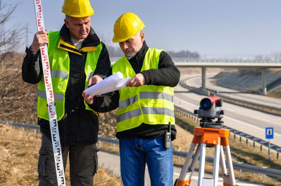
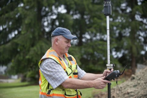
Land surveyors like Scalice Land Surveying work in the office and in the field. In the field, they use the latest technology such as high order GPS, Robotic Total Stations (Theodolites), and aerial and terrestrial scanners to map an area, making computations and taking photos as evidence.
What do land surveyors do?
In the office, Surveyors then use sophisticated software, such as Auto-cad to draft plans and map the onsite measurements. Surveyors work on a diverse variety of projects from land subdivision and mining exploration, to tunnel building and major construction, which means no two days are the same. They are experts in determining land size and measurement. They also give advice and provide information to guide the work of engineers, architects and developers.
What is the importance of land surveying?
According to Renishaw plc, laser scanning is not only used in land surveying but is being adopted in more and more industries, since it gives detailed, accurate data, very quickly, and with fewer manpower requirements, saving companies costs. Surveying is important and most of us depend on it so as to ensure order in the physical world around us.
Surveyors play an integral role in land development, from the planning and design of land subdivisions through to the final construction of roads, utilities and landscaping. Surveyors are the first people on any construction site, measuring and mapping the land. These primary measurements are then used by architects to understand and make the most of the unique landscape when designing and engineers to plan structures accurately and safely, ensuring buildings not only fit with the landscape but are able to be constructed.
According to Haglöf Sweden AB, It is valuable for everyone to keep track of assets to maintain control and healthy growth. Standardization, calibration and control systems are used in all industries, and when measuring, storing and processing data on-site, error sources are efficiently minimized. Problem areas are detected in time and actions are based on facts and figures.
It is necessary to mark the boundaries on the ground, so that they are clear to observers standing on or near the property. Also surveying is intended to provide the evidence needed by the title insurer to delete certain standard exceptions to coverage and thereby provide “extended coverage” against off-record title matters including matters that would be revealed by an accurate survey.

Many properties have considerable problems in regard to improper bounding, miscalculations in past surveys, titles, easements, and wildlife crossings. Also many properties are created from multiple divisions of a larger piece over the course of years, and with every additional division the risk of miscalculation increases. The result can be abutting properties not coinciding with adjacent parcels, resulting in gaps and overlaps.
Many times a surveyor must solve a puzzle using pieces that do not exactly fit together. In these cases, the solution is based upon the surveyor’s research and interpretation, along with established procedures for resolving discrepancies. This essentially is a process of continual error correction and update, where official recorded documents countermand the previous and sometime erroneous survey documents recorded by older monuments and older survey methods.
Today however latest technologies have emerged to help land surveyors with their work.y using a GPS system, a land surveyor can take accurate measurements from a large area of a land. With this technology, a single survey can do what used to take an entire team of people to accomplish, and they can complete the task in half the time, if not less. While GPS is used in a wide variety of industries, land surveyors were some of the first to take advantage of and realize the full potential of the technology
Hi Patrick! Thanks for letting us know about such amazing information on land surveyor. As it is very importanrt to do survey of land before doing anything on it. It makes us aware of feasibility of the land. Very informative blog!
Great content about landsurveyors, The instruments used by technology are also changing which is very useful for us. We get very accurate results from them.
Your article about land surveyors are gives very good information mainly importance of land surveying is very helpful to us.
I didn’t realize that land surveyors plan out where the roads and utilities are going to be in a new subdivision. My grandparents are wanting to sub-divide some farm land that they have and want to make sure they plan out everything correctly. I will have to let them know that it would be a good idea to call in a professional.
Gps is very wonderful .
Elaboration
clear elaboration
It would be nice to have detailed and accurate data for a site without using lots of manpower. Maybe it would be good to have land divisions and surveying done before starting construction. That is something I would want to have if I were in construction.
I’m glad you mentioned that land surveyors are the first people on the site of a construction project, since it’s their job to measure and map the land. My husband and I are interested in having a custom home built. I wasn’t sure who to hire to start the construction process, so thanks for sharing that info here!
It’s really interesting that property surveyors are able to work on projects including land subdivision to major construction to mining exploration. This makes me wonder if they can also settle border disputes between neighbors. I have a neighbor who claims that my trees are his and he won’t let me cut them down even though they are starting to rot.
Wow, it sure is interesting to know that land surveyors will also be able to guide the work of your architects and engineers for your project. My mother wants to build a luxury home of her own up in the mountains. She wants it to be her legacy that she will leave to us, so I think she will need a good team of land surveyors, designers, and architects to guarantee the best results.
That is really interesting that surveyors are the first people on any construction site measuring and mapping the land. That sounds like it would be really important for the planning of the construction project. If I were a construction manager then I would want to get a surveyor on site as soon as possible.
My husband’s company is planning to buy a piece of land to build a new retail store on and they want to get the land surveyed first, so I am glad that I found this article. You make a great point that the surveyor will clearly mark the boundaries and coverage of where to build with complete accuracy. This way, my husband can make sure that the dimensions he wants for the building fit within that space of land. I will make sure to share these benefits with him.