Groundwater assessment plays a vital role in protecting drinking water supplies and ensuring sustainable water management. This comprehensive guide highlights essential methods and best practices for evaluating groundwater systems, from data collection and monitoring to analysis and decision-making, helping stakeholders manage groundwater resources effectively and responsibly. Explore further information at alphaenvironmental.com.au
Overview and Regulatory Context
A defensible groundwater assessment combines policy drivers, science-based methods, and practical tools to safeguard groundwater supplies and protect public health. In California, the Groundwater Ambient Monitoring and Assessment (GAMA) Program, established by Assembly Bill 599 and administered by the State Water Board, provides a statewide model for comprehensive monitoring and transparent water quality information. Through collaboration among state, federal, and academic partners, GAMA supports effective water management, groundwater cleanup, and safe drinking water outcomes.
GAMA’s Interagency Task Force and Public Advisory Committee ensure groundwater monitoring addresses technical requirements and community priorities for public water systems and private domestic well users. Integrated groundwater data, risk mapping tools, and publications improve access to water quality information for well owners, local water agencies, and regional water boards while supporting the state’s groundwater act, environmental assessments, and long-term protection of critical water resources.
Scoping and Conceptualization: Objectives, Regulatory Context, Data Inventory, and Conceptual Hydrogeologic Model
Objectives and Regulatory Context
Purpose hierarchy and decision questions
Start by clearly defining the decision context—whether for source delineation, drinking water quality assessment, new well siting, or private well risk evaluation—and specify policy endpoints and how groundwater monitoring and testing results will guide protection and management of groundwater resources.
Regulatory triggers and compliance alignment
Map requirements from the State Water Board, DDW, regional boards, and local agencies to align monitoring with safe drinking water regulations, integrating GAMA and groundwater act expectations to ensure consistency with statewide water management and environmental assessment goals.
Stakeholder and interagency collaboration
Identify key stakeholders and define interagency roles, using guidance from the ITF and PAC to ensure the assessment and monitoring program addresses community needs and provides accessible water quality information for well users.
Data Inventory and Conceptual Model
Sources of groundwater data and water quality information
Compile existing groundwater data from GAMA, DDW, USGS, local programs, CV-NPSAT, and academic studies, including well construction, aquifer characteristics, water sources, and historical quality trends, to inform sampling design and identify monitoring gaps.
Conceptual hydrogeologic model elements
Develop a conceptual hydrogeologic model that links recharge areas, aquifer structure, pumping centers, and contamination sources, incorporating vertical stratification and well depths to guide groundwater flow, vulnerability analysis, and targeted monitoring.
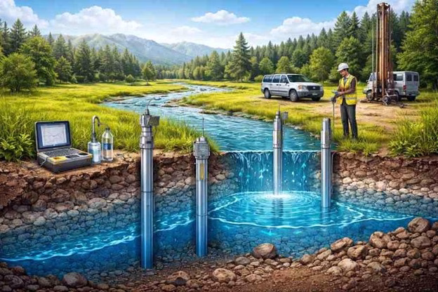
Field Methods: Reconnaissance, Well Siting/Design, Drilling/Logging, Aquifer Tests, and Monitoring Networks
Reconnaissance, Siting, and Design
Conduct field reconnaissance and use GIS to guide well siting that represents key hydrostratigraphic units and water-use areas, considers contamination risks and hydraulic conditions, and ensures well designs isolate target aquifers for long-term groundwater and water quality monitoring.
Drilling, Logging, and Aquifer Testing
Use site-appropriate drilling and logging methods with hydraulic testing and nested or multilevel monitoring wells to characterize aquifer properties, capture vertical groundwater conditions, and ensure representative, repeatable groundwater assessment through proper well development and documentation.
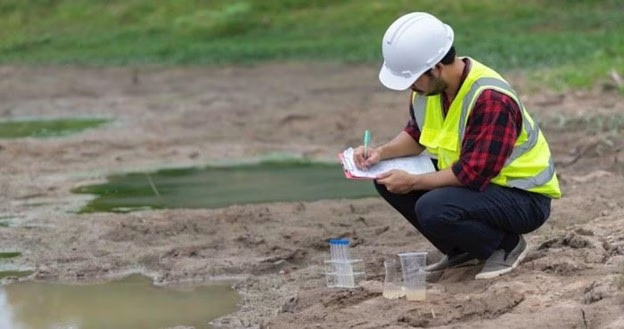
Water Quality Assessment: Sampling Design, Purging/Filtration, Analytical Suites, QA/QC, and Data Validation
Design water quality assessments to capture spatial and temporal variability through stratified sampling and standardized field methods, using decision-driven analytical suites with rigorous QA/QC and validation to produce defensible data that supports effective groundwater monitoring and management.

Data Synthesis and Modeling: Recharge and Water Balance, Flow/Transport Models, Calibration, Sensitivity, and Uncertainty
Recharge should be estimated using multiple lines of evidence and balanced inflows and outflows to develop a defensible water balance, supported by calibrated groundwater flow and transport models that incorporate transient conditions, sensitivity analysis, and uncertainty to inform risk-based decisions. Model results should be integrated with GIS and water technology tools to create basin-specific risk maps and decision-ready products that guide well siting, groundwater cleanup, and alignment with regulatory and community priorities.
Data Management, Reporting, and Best Practices: Standards, Visualization, Documentation, and Stakeholder Communication
Establish early data standards and interoperable databases to integrate groundwater monitoring, analytical, and modeling data, and present results through clear maps and dashboards that support technical analysis and public understanding. Document and share methods and findings through coordinated reporting with regulatory agencies and partners to ensure reproducibility, transparency, and effective stakeholder engagement.
Best practices emphasize aligning monitoring design with conceptual models and decision goals, maintaining transparent data workflows, using GIS-based risk maps to target resources, leveraging interagency collaboration, and linking groundwater quality trends to practical management actions that support long-term water supply resilience.