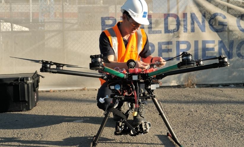
In today’s dynamic world, surveying has evolved beyond the confines of traditional methods. Enter the era of drone surveying, a groundbreaking innovation that is revolutionising industries, from construction and agriculture to disaster management. In this article, we’ll delve into the many benefits of using drones for surveying, demonstrate why it’s a vital tool, and discover how it operates.
Unlocking the Power of Aerial Perspectives
Imagine having the ability to access vantage points previously deemed inaccessible or risky. That’s precisely what drone surveying services bring to the table. They provide a bird’s-eye view of the landscape, structures and terrains, seamlessly capturing data that would have been troublesome, time-consuming, or even unstable to obtain through traditional ground-based methods.
Swift Deployment and Precise Data Capture
One of the greatest advantages of drone surveying is its rapid deployment capability. Unlike conventional surveying teams, drones can be dispatched swiftly to the survey site, expediting data collection. These unmanned aerial vehicles are equipped with a variety of advanced technologies, including cameras, 3D laser scanners, and thermal imaging systems, which work in harmony to capture intricate details with remarkable precision.
Mapping the Unseen with Unmanned Aerial Surveys
Drones, as versatile tools, are not confined by the limitations of human reach. Whether it’s surveying rugged terrains or navigating through hazardous areas, they rise to the occasion, ensuring that no data is beyond reach. This attribute proves particularly invaluable in the aftermath of natural disasters such as floods, fires, and landslides. Drone surveying services provide a secure means to assess and evaluate the damage sustained by terrain, infrastructure, and buildings in emergency scenarios.
Making Informed Decisions
In the world of business and industry, informed decisions reign supreme. Drone mapping and surveying provide organisations with a vast amount of data that forms the base of strategic planning. By offering comprehensive insights into topography, terrain changes, and structural conditions, these services empower decision-makers to chart a course forward with clarity and confidence.
Precision in Every Pixel: How Drone Surveying Works
Diving into the mechanics of drone surveying reveals a symphony of technology at play. Licensed operators first establish control points across the designated survey area and then drones take flight to capture hundreds of high-resolution images. These images serve as the raw material for creating detailed maps, models, videos, and photographs.
The magic happens in the data processing phase, where cutting-edge artificial intelligence then processes the information. Employing sophisticated algorithms, AI stitches these images together, creating seamless and accurate representations of the surveyed area. This digital tapestry forms the basis for informed decision-making.
Infrared and Thermal Imaging: Highlighting Key Insights
The capabilities of drone surveying extend beyond mere visual data. Incorporating infrared and thermal imaging adds another layer of functionality. These technologies can unveil crucial details that might remain hidden from the naked eye. Roads, rail corridors, crop health, and property boundaries come into sharp focus, aiding professionals in diverse fields.
Enhancing Agriculture and Crop Management
Agriculture, the foundation of civilisation, has greatly benefited from drone surveying. These aerial drones have transformed the way farmers manage their fields. Drones, equipped with multispectral cameras, monitor crop health with unparalleled precision. They capture data on plant vitality, detecting early signs of stress or disease that are often invisible to the human eye.
With this data in hand, farmers can implement targeted interventions, such as adjusting irrigation schedules or applying fertilisers where they are needed most. The result? Increased crop yields, reduced resource waste and a more sustainable approach to agriculture.
Efficiency in Construction and Infrastructure
In the world of construction, time is money. Drones have become indispensable for surveying construction sites, providing real-time insights that keep projects on track. Traditional land surveys are time-consuming and can lead to costly delays. Drones, on the other hand, can map construction progress quickly, flagging any deviations from the plan.
Moreover, drones enhance safety on construction sites. They can assess potentially hazardous areas without putting human surveyors at risk. This dual benefit of efficiency and safety translates into substantial cost savings and improved project management.
Disaster Response and Recovery
Natural disasters can strike with little warning, leaving devastation in their wake. Drone surveying plays a pivotal role in disaster response and recovery efforts. In the aftermath of events like hurricanes, earthquakes, or wildfires, drones can quickly survey the affected areas.
They provide crucial information about the extent of damage to infrastructure, roads, and buildings. Thermal imaging helps locate survivors who might be trapped or injured, guiding rescue teams to the most critical areas. Furthermore, drones can assess environmental damage, such as oil spills or chemical leaks, allowing for a more targeted and effective cleanup.
Environmental Conservation and Monitoring
Beyond agriculture and disaster management, drone surveying extends its reach to environmental conservation. Conservationists and researchers employ drones to monitor wildlife populations, track deforestation, and assess the health of ecosystems.
Drones can fly low and quietly, making them ideal for observing wildlife without causing undue disturbance. Their ability to cover vast areas efficiently aids in wildlife conservation efforts. By tracking animal movements, monitoring illegal activities like poaching, and gathering data on habitat health, drones are invaluable allies in preserving our planet’s biodiversity.
Conclusion: Elevating Possibilities with Drone Surveying
In the realm of modern surveying, drone technology stands as a beacon of progress and efficiency. It holds the power to transcend physical barriers, collect precise data, and make decisions grounded in knowledge. From expediting emergency response to optimising resource allocation in industries like agriculture and construction, the benefits are abundantly clear.
Drone surveying isn’t just about soaring above landscapes; it’s about soaring above limitations, unlocking a future where precision and efficiency reign supreme. As technology continues to advance, we can only imagine the new heights that drone surveying will reach, reshaping industries and fostering a safer, more sustainable world. The sky is not the limit; it’s just the beginning.

