ITS America 2026 in Detroit laid it bare: connected transport has moved out of the innovation lab and into the domain of civil engineering, network management, and long-term asset maintenance. The challenge now isn’t pulling off a demo; it’s the grinding work of upgrading live public corridors with new sensors, signals, and data networks while keeping traffic moving safely.
Across the country, road authorities are scaling successful trials into permanent, network-wide operations backed by measurable returns:
- Washington, D.C.: Following a successful year-long pilot, the District Department of Transportation (DDOT) announced the expansion of its smart traffic signal monitoring platform to more than 1,600 intersections to drive citywide, data-driven traffic management.
- Harris County, Texas: Seven Emergency Service Districts are deploying new traffic signal sensors to improve emergency vehicle response times, providing a clear, life-saving metric to justify infrastructure spending.
- TxDOT Highway 130: The Texas Department of Transportation recently opened a fully operational smart corridor. Using cameras, LTE antennas, and AI processing to deliver real-time hazard alerts, the project establishes a new baseline for active, permanent highway management rather than serving as a temporary testbed.
What Physical Infrastructure Is Required for a Connected Corridor?
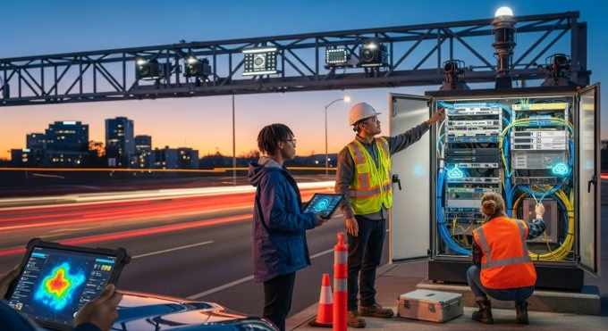
Building a connected corridor involves far more than software. It requires significant field installation and integration of ruggedized hardware, the kind that can handle extreme temperatures, vibration, and years of weather exposure. These physical components form the foundation for collecting data, communicating with vehicles, and managing traffic flow in real time. The scope of work now regularly combines civil construction with advanced electrical, networking, and IT expertise.
The TxDOT SH 130 Smart Corridor illustrates this multi-disciplinary build-out on the ground. Deploying these edge sensors and communication arrays required precise coordination between traditional civil trenching for fiber-optic lines and the electrical installation of mast-arm-mounted cameras and antennas that deliver a unified operational view of the roadway. Other projects have pushed the definition of connected infrastructure even further. In Spain, for instance, road authorities have deployed smart roadwork cones that transmit their location to a central system, enhancing work zone safety for maintenance crews.
| Infrastructure Layer | Typical Field Components | Construction/Installation Implications | Main Operational Benefit
|
| Sensing | Cameras, radar, LiDAR, detection units | Pole mounting, power supply, calibration, line-of-sight planning | Real-time roadway awareness |
| Signals | Controllers, cabinets, detection cards, UPS | Cabinet retrofit or replacement, wiring, controller integration | Adaptive and connected traffic control |
| Communications | Fiber optic cable, LTE/5G modems, antennas, network switches | Trenching, conduit installation, network setup, cybersecurity hardening | Reliable and secure data exchange |
| V2X | Roadside units (RSUs), antennas, security credentials | Pole or mast arm mounting, network testing, standards compliance | Vehicle-to-infrastructure messaging |
| Data Platforms | Edge computing devices, cloud dashboards, APIs | Systems integration, IT department coordination, software configuration | Monitoring, analytics, and alerts |
How Do Agencies Prove Existing Conditions Before Upgrading Roads?
Before any major connected road project kicks off, agencies need to follow fundamental engineering discipline by establishing a clear picture of existing conditions. This involves collecting detailed baseline traffic data to justify design choices, measure the impact of improvements, and make sure new systems deliver the intended benefits without creating new safety or congestion problems. Skip this step, and you’re essentially flying blind on a multimillion-dollar investment.
Baseline Data Still Drives Corridor Design
The key metrics typically include turning movement counts at intersections, corridor volume counts by lane, speed studies, and pedestrian and cyclist pathway counts. This foundational data informs everything from traffic signal retiming plans to the strategic placement of sensors and roadside units. Without it, you simply can’t quantify the return on a substantial capital deployment with any confidence.
Before agencies install new roadside units, retime signals, or add corridor management software, they typically need verified baseline counts, speed data, and movement patterns. Portable traffic collection tools, such as the Miovision Scout Plus, that support short-term studies without adding unnecessary field exposure are commonly used for this purpose. Video-based systems are increasingly popular because they can support remote review, multimodal counts, and auditable traffic studies across intersections, corridors, and pathways.
What Changes for Contractors, Traffic Engineers, and Smart City Teams?
The shift to operationally connected corridors changes the responsibilities and skill requirements for nearly every stakeholder involved in road projects. Traditional boundaries between civil construction, electrical work, and information technology are blurring, requiring greater collaboration from project inception through long-term maintenance.
The Road Project No Longer Ends at Concrete and Steel
For civil contractors, the scope of work is expanding in ways that would’ve seemed unlikely a decade ago. Road and intersection projects now frequently include significant electrical and communications subcontracts for installing sensors, running fiber, and commissioning network hardware. Project phasing has to be meticulously planned to avoid signal downtime, and final acceptance testing increasingly includes cybersecurity and network performance verification.
For traffic engineers and public agencies, operations become more continuous. Instead of relying on periodic manual traffic counts and reactive signal timing adjustments, teams now have access to real-time performance dashboards. As NYC’s expanding sensor network shows, this data allows for a much deeper understanding of how all road users (including pedestrians and cyclists) interact with the street network. That’s a significant upgrade from counting cars once a year with a clipboard.
What Are the Biggest Obstacles to Scaling Connected Roads on Live Networks?
Despite the technological progress, deploying connected infrastructure at scale on live road networks presents serious practical and institutional challenges. The primary barriers often aren’t the sensors or software themselves. They’re the complexities of integrating new systems with legacy infrastructure, securing funding, and establishing new operational workflows.
Many road authorities manage a mixed estate of aging traffic signal controllers and cabinets, some of which simply can’t support modern connected applications. As seen in Connecticut’s signal replacement programs, modernization often starts with the foundational task of upgrading old hardware. On top of that, ensuring reliable communications backhaul can be extremely difficult in areas with limited fiber-optic connectivity. At ITS America 2026, technology provider Commsignia framed this as the challenge of creating “trusted roadway intelligence”, which requires stitching together data from vehicles, cameras, and sensors into a single validated operational picture.
Before activating a connected corridor, agencies and their partners need to address several site-level requirements to support a successful deployment. These checks help reduce common risks tied to construction, integration, and long-term operations:
- Confirm baseline traffic and safety conditions to establish a performance benchmark.
- Audit existing signal controller and cabinet hardware for compatibility and power requirements.
- Verify the availability and capacity of power, communications, and data backhaul.
- Plan for lane closures, traffic management, and system commissioning windows to minimize public disruption.
- Define clear roles for data ownership, cybersecurity protocols, and ongoing maintenance responsibilities.
Where Does the Connected Corridor Model Go Next?
The future of connected roads will be shaped by practical, use-case-driven deployments rather than abstract smart-city ambitions. The most immediate priorities for many agencies include signal modernization, implementing emergency vehicle preemption, enabling adaptive traffic control, and improving incident detection to reduce secondary crashes. The expansion of these systems is becoming a standard component of major transport capital programs, sitting alongside large-scale highway and rail investments like the Brightline West high-speed rail project.
Success will depend less on inventing new technologies and more on mastering the discipline of building and maintaining them as durable public infrastructure. The next real milestone for the industry isn’t another successful pilot project. It’s demonstrating that these complex digital systems can be operated reliably and cost-effectively across their full asset lifecycle. And if the pace of deployment coming out of ITS America 2026 is any indication, that proof point isn’t far off.
Frequently Asked Questions
What’s the difference between a smart corridor and a connected corridor?
A smart corridor typically uses adaptive systems and sensor-driven monitoring to optimize traffic flow. A connected corridor adds a layer of direct communication, enabling roadside infrastructure to exchange information with management platforms and, in some cases, with vehicles (Vehicle-to-Infrastructure, or V2X). The distinction matters because connectivity creates opportunities for real-time responsiveness that standalone smart systems can’t match.
Do connected roads always require V2X hardware?
No. Many deployments begin with foundational elements like connected traffic signals, advanced roadside sensing, and cloud-based corridor monitoring. Full V2X messaging capabilities, which require dedicated roadside units, are often added in a later phase as vehicle connectivity becomes more widespread. This modular approach allows agencies to scale their digital infrastructure incrementally as vehicle adoption grows.