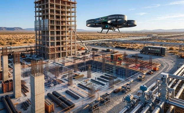
Every large construction project runs on the same basic question, asked over and over again: where does the work actually stand right now? Owners want to know before releasing payment, lenders want to know before disbursing the next draw, and project managers need an accurate picture before making scheduling decisions. For most of the industry’s history, answering that question has meant someone walking the site with a clipboard or a camera, documenting progress section by section, then compiling it into a report days later.
That process is starting to look outdated on larger, more complex sites, and companies like us are part of why aerial-based progress tracking is becoming a standard part of how projects get monitored.
The limits of manual site documentation
Walking a site to check on progress works fine for small jobs, but it doesn’t hold up on bigger ones. On a large development, a high-rise with mixed uses, or a long stretch of road or pipeline, just walking the whole site can eat up most of a day, and even then you only see what’s visible from the ground. It’s hard to get a real sense of roof work, elevated structural work, or how much earth has actually been moved just by looking up from below. By the time someone writes that report and gets it into the right hands, the site has usually already moved on to whatever comes next.
This lag matters more than it might seem. Payment draws, schedule adjustments, and stakeholder reporting all depend on progress data that’s current, and a documentation process that takes days to compile and distribute works against that need by design.
What aerial monitoring changes
A drone flying the same route over a site each time captures the whole overhead view fast, much faster than someone walking the ground ever could. And it can do that on a set schedule, whether that’s weekly, every two weeks, or right after a big milestone. You’re not relying on who happened to walk the site that day or which angles they thought to shoot. That’s what makes the real difference. Progress tracking stops being a bunch of random snapshots and starts becoming something you can actually line up and compare over time. The imagery itself can do more than just show what things look like, too.
Processed into orthomosaic maps or 3D models, aerial data makes it possible to calculate earthwork volumes, track structural progress against a project timeline, and compare current conditions directly against design plans, work that would otherwise require separate survey visits or manual measurement. This kind of construction drone services work is what Drone As A Service provides to contractors and developers managing complex builds.
Where this shows up in project outcomes
For owners and lenders, faster and more consistent progress data means to draw requests and reporting cycles that better reflect actual site conditions rather than a documentation process lagging a week or more behind reality. For project managers, having a reliable, repeatable view of the whole site, not just the sections a walk-through happened to cover, makes it easier to catch scheduling conflicts or quality issues earlier, when they’re still cheap to correct.
This shift toward aerial progress monitoring is part of a broader pattern across the construction industry, where projects that once depended entirely on ground-level documentation are increasingly layering in aerial data as a standard part of project management, alongside traditional site visits rather than replacing them outright.