On most Calgary projects, the surveyor is one of the first professionals on site and one of the last people anyone thinks about. That’s a mistake. Mistakes in survey data tend to show up late, when a foundation is already poured or a permit is already under review, and fixing them then costs far more than getting them right at the start.
For builders, developers and project managers working in Calgary, here is what to line up with a land surveyor before the first excavator shows up.
Know Who Can Do the Work
In Alberta, legal surveys that define property boundaries must be done by an Alberta Land Surveyor (ALS). It’s a regulated profession, and the title is protected. Engineering and construction surveys can involve a wider team, but any work that relies on where a property line actually sits should trace back to a licensed surveyor.
The Alberta Land Surveyors’ Association regulates the profession in the province. Its site lets you confirm a surveyor’s registration and explains documents such as Real Property Reports and boundary markers. If your team is new to building in Alberta, it’s a good place to get familiar with the terms before kickoff meetings.
Start With Accurate Existing Conditions
Design teams need a reliable picture of the site as it is today. Before any drawings are finalized, most projects benefit from:
- A boundary confirmation. Where are the legal property lines, and are the survey monuments still in place?
- A topographic survey. Existing grades, spot elevations, trees, structures, curbs, sidewalks and visible utilities.
- Easements, rights of way and restrictive covenants. These are registered on title and can limit where you build. Your surveyor can show them on a plan, and your lawyer or title search will confirm what’s registered.
On larger or more open sites, drone (UAV) mapping can speed up data capture. Ask your surveyor whether it suits the project and what level of accuracy you can expect.
Prepare for the Permit Stage
The City of Calgary expects accurate site information in permit applications. For many residential infill projects, the development permit checklist asks for a site plan showing property lines, buildings, existing and proposed grades and geodetic elevations at key points, such as parcel corners and the main floor.
Some applications also need streetscape drawings, which show how the proposed building relates to its neighbours in height and scale. These depend on accurate elevation data for the adjacent properties.
Requirements vary by project type and change from time to time. Check the current City checklist for your specific application and share it with your surveyor early so nothing gets missed.
Plan the Construction Layout
Once permits are approved, the survey work shifts from mapping to staking. Typical construction survey tasks include:
| Stage | What the surveyor provides | Why it matters |
| Pre-excavation | Building corners and offsets staked from the approved plan | Keeps the building within setbacks |
| Footings and foundation | Checks on location and elevation | Catches errors before walls go up |
| Utility and grading work | Grade stakes and alignment | Supports proper drainage and servicing |
| Framing or as-built | Confirmation of final position | Supports inspections and closeout |
Agree on this schedule before construction starts. Surveyors’ calendars fill up quickly during Calgary’s busy building season, and a site that waits two days for layout is a site paying for idle crews.
Coordinate Utilities and Safety
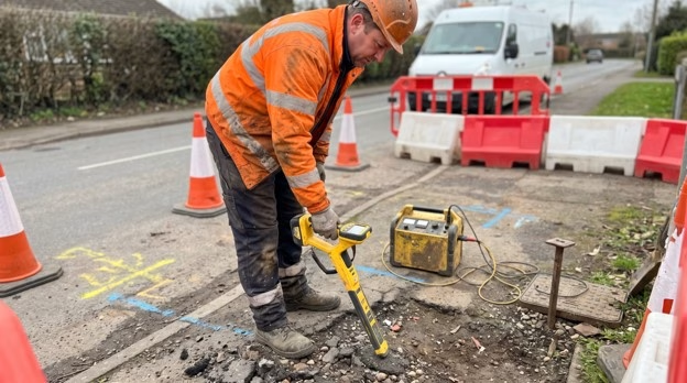
Survey drawings show visible features, but buried lines need a separate process. In Alberta, anyone planning to dig is expected to request locates through Utility Safety Partners’ Click Before You Dig service before ground disturbance. Build enough lead time into the schedule for locates to be completed.
Share locate results with your surveyor and design team. Conflicts between a proposed footing and a buried line are much cheaper to solve on paper than in the trench.
Choosing a Surveying Partner
When comparing survey firms, look past the price per job. Things that make a real difference on site include:
- Local experience. Calgary has its own permit rules, older subdivisions with tricky records and fast moving infill areas. A surveyor who works here regularly knows what the City expects.
- Clear turnaround times. Ask for realistic dates for each deliverable, including how long municipal reviews tend to add.
- Range of services. A firm that can handle boundary work, topographic surveys, permit drawings and construction layout keeps your data consistent from start to finish.
- Communication. You want someone who answers the phone when a stake gets knocked over.
Calgary firms such as Third Rock Geomatics, which handles Real Property Reports, topographic and development permit surveys and construction surveying, are the kind of local partner worth talking to early in planning rather than the week before excavation.
Don’t Forget the Finish Line
Survey work doesn’t end when the building is up. Many projects need final documentation, such as an updated Real Property Report showing the completed structure, before the property can be sold or refinanced. In Calgary, an RPR is often submitted to the City for a compliance review, which adds its own processing time.
Planning for that final survey at the start of the project avoids a scramble during closeout.
The short version: bring your surveyor in early, give them the permit checklists and design files they need, and schedule their site visits as carefully as any other trade. It’s one of the simplest ways to keep a Calgary project on time and out of trouble.